
Yesterday I went along with my (well they will be my class when I am back at school anyway) Earth and Space Science class on their field trip to the Castle Hill area. This was done with the help of a Masters student from the geology department who was extremely useful and explained things really well to the class.
Unfortunately it was very cloudy at the top of Porters Pass so we could not see the fault there, but the weather improved down the other side and we were able to see some examples of the rocks that make up the area.

We started at Castle Hill, checking out the limestone formations there. These limestone formations appear to dominate the landscape, but there is actually very little limestone compared to the older Torlesse rocks (sandstone, mudstone, greywacke). The limestone formed on top of the older basement Torlesse rocks when they were submerged by a large, shallow inland sea, which was inhabited by many shell forming organisms. These left behind the calcium carbonate shells that formed the limestone.


Our second stop was in the Cave Stream area, where we looked at how the cave formed from the stream eroding of the limestone.

The old stream bed is clearly visible here, where the path runs now. The cave entrance is just to the right of this photo. You can see how the stream eroded a path through here, before finding an easier route through the cave it eroded.


The current stream, and some boulders of greywacke from the Torlesse rocks, against the limestone of the cave. The greywacke is much tougher and will erode less. As the rocks get further downstream they get smoother and rounder as they are tumbled in the water.

In the cave stream area there are lots of lovely exposed faces cut by the river channels that geologists can use to see what has happened to the rocks by the angles they are all on, and also what is in each layer of rock. In the background you can also see the smooth flat planes caused by glaciation.

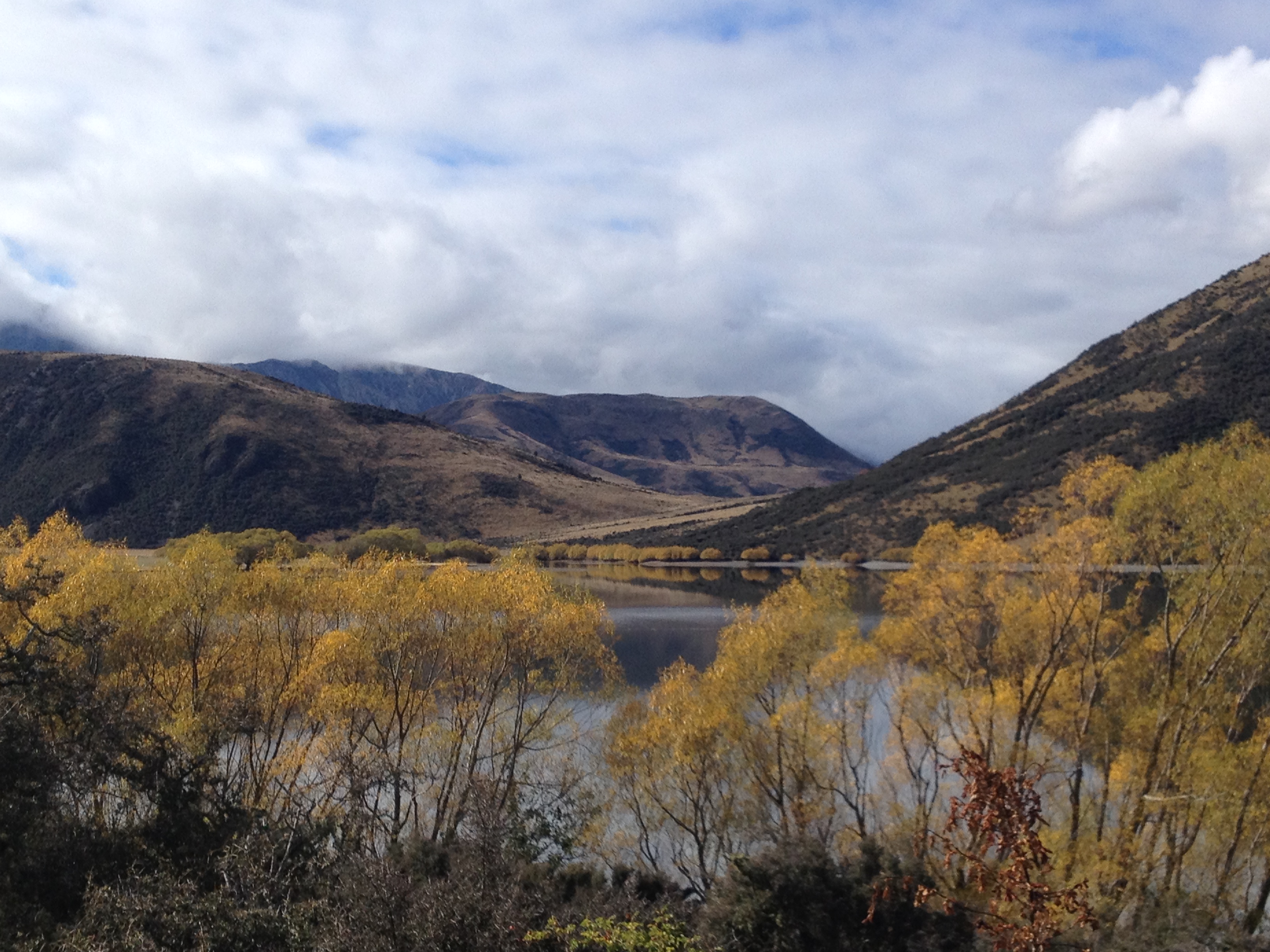
Our final stop was Lake Pearson. Here we were looking at evidence of glaciation and postglacial erosion. The points where glaciers stopped is generally marked by a moraine, a ridge of sediment that has been pushed in front of a glacier as it advances.
When the glaciers melt, the water is left behind in depressions created by large chunks of ice. The melting also brings large amounts of sediment down, leveling out valley floors.
The erosion is always continuing, and Lake Pearson is very nearly divided in two by debris fans from the mountains either side.


It was as exceptionally beautiful day down at the lake.


Wow what a glorious place – looks amazing – and very informative recount 🙂
LikeLike
Thanks 🙂
LikeLike